

Knockanore [Cnoc an Fhomhair]
Good walks are even better shared.
Overview
Knockanore [Cnoc an Fhomhair]
Knockanore, or Cnoc an Fhomhair as the locals affectionately call it, stands tall at 455 meters and delights hikers with its striking views and rich geology. Located in Northern Ireland, this Marilyn offers an escape into nature with a dash of adventure.
Geology
Knockanore is primarily composed of limestone, creating fascinating karst topography that not only shapes the landscape but supports a diverse ecosystem of rare plants and wildlife.
Routes
The Knockanore Loop Trail is the gem of this mountain, not to be missed! At approximately 6.5 km, this route is deemed moderate, taking about 2.5 hours to complete. Starting from the village of Greencastle, hikers journey through woodlands and open landscapes, soaking in the refreshing Irish air.
Summit Features
Arriving at the summit, climbers are greeted by a modest stone cairn. It's the perfect spot for a celebratory selfie or, if you’re feeling particularly poetic, a sunset haiku.
Terrain Type
The hike offers a mix of grassy areas and rocky outcrops, ideal for adventurous spirits but watch your step! Be prepared for some boggy patches, especially after a hearty rain shower.
Views
The summit promises breathtaking vistas, showcasing Lough Foyle and the majesty of Donegal to the west. On a clear day, the Sperrin Mountains loom invitingly to the south, begging for exploration. Spring and autumn are particularly splendid seasons for this trek, offering clarity and vibrant colours.
Hazards
While the hike is generally accessible, hikers should remain cautious of changing weather conditions and the occasional soggy terrain. Proper footwear is highly recommended—this isn’t the occasion for your Sunday best!
Nearby Summits
Consider continuing your adventure to nearby peaks such as Slieve Snaght (709 m) and Mullaghcarn (650 m) for further exploration and stunning views.
Access
You can conveniently park in the village of Greencastle, a mere km from the trailhead. Public buses from Derry frequently service the area, making public transport a viable option.
Facilities
After a long day of hiking, you can indulge in local cafes and pubs in Greencastle, where a well-deserved cup of tea or a hearty meal awaits you. Public toilets are also available in the village.
History
The name 'Knockanore' translates as 'Hill of the Giants', inviting due respect as you tread upon its ancient ground. Its historical significance is steeped in Celtic folklore, chronicling tales of times long past.
Whether you’re an experienced hiker or a weekend wanderer, Knockanore offers a charming escape amidst the stunning landscapes of Northern Ireland. So grab your hiking boots, pack your sense of adventure, and make your way to this enchanting hill!
Explore routes near Knockanore [Cnoc an Fhomhair]
Public walks starting within 80 km of this hill. Nearby does not mean a route reaches the summit; check its map and access before setting out.
No public routes are currently listed within 80 km of Knockanore [Cnoc an Fhomhair] on Walkmates. This does not mean there are no paths here. Explore the map and check local access information before planning a walk.
Route planning notes
These notes describe possible approaches, not verified navigable routes or permission to cross land. Check current paths, local access rules and conditions before setting out.
Knockanore Loop Trail
A scenic loop trail starting from the village of Greencastle, leading you through beautiful woodlands and open landscapes.
Make a day of it, together
Find someone to share the walk with, or organise a day out along a route you like.
Photo Gallery
View all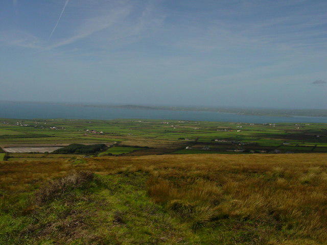 Photo could not load
Q9042 : On Knockanore Mountain
Colin Park
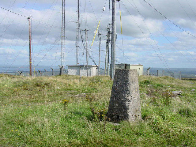 Photo could not load
Q9142 : The trig point on Knockanore Mountain
Colin Park
Hill facts and local notes
Classifications
Elevation
266m
871 ft
Prominence
238m
Coordinates
52.5239, -9.6066
Q910425
OS Map
63
At the Summit
The summit is marked with a small stone cairn, which provides a great photo opportunity for those seeking to document their adventures.
Terrain & Geology
The mountain primarily consists of limestone, creating a unique karst landscape that is home to various rare flora and fauna.
Views & Scenery
From the summit, you can enjoy breathtaking views of Lough Foyle, Donegal, and the Sperrin Mountains to the south.
History & Heritage
Name Origin
The name Knockanore translates to 'Hill of the Giants' in Irish, which adds a touch of mythical charm to this natural wonder.
Historical Significance
The area is steeped in local folklore and history, with connections to ancient Celtic landscapes.
Getting There & Facilities
Check current local access restrictions, parking rules and transport timetables before travelling. These notes do not confirm public access to the summit.
Parking
There is a small parking area in the village of Greencastle, approximately 1 km from the starting point of the trail.
Public Transport
Regular bus services operate from Derry to Greencastle, making it accessible via public transport.
Nearby Facilities
There are local cafes and pubs in Greencastle where hikers can refresh after their trek, along with public toilets.
Safety Information
Known Hazards
- Be cautious of sudden weather changes and consider the boggy terrain when planning your hike.
General Safety Tips
- Check weather conditions before setting out
- Carry appropriate clothing and equipment
- Let someone know your planned route
- Take a map, compass, and GPS device
- Carry emergency supplies: food, water, first aid kit, torch
Hills
Some common questions about the hills answered
Are there group walks up Knockanore [Cnoc an Fhomhair]?
Many walkers use Walkmates to join or organise walks with others. You can check for group walks around Knockanore [Cnoc an Fhomhair] through the maps
Are there other walkers around Knockanore [Cnoc an Fhomhair]?
Activity varies by location and time, but Walkmates lets you see whether others have shared walks or shown interest in this area. Find other people through the walking friends search walking friends for Knockanore [Cnoc an Fhomhair] search or of course create your own walk for Knockanore [Cnoc an Fhomhair]
Can I organise a walk to Knockanore [Cnoc an Fhomhair]?
Yes. If there aren’t any walks listed already, you can create a walk and make it available for others to join.
If you're signed up to Walkmates, you can create a walk to Knockanore [Cnoc an Fhomhair].
How do I find a walk up this hill?
There are often multiple ways to walk this hill, depending on experience and route preference. Walkmates helps you explore walks and routes that others have shared.
Can I suggest a new route up Knockanore [Cnoc an Fhomhair]?
Yes. You can suggest or create routes to share with others. Walkmates focuses on the social side of walking, so routes are used to help people organise walks and explore areas together, rather than as detailed navigation tools or route libraries.
Other uses really appreciate knowledgeable walkers sharing their routes. Share your favourite route to Knockanore [Cnoc an Fhomhair] here
The is an error or something incorrect about this hill. How do I let you know?
We always strive to keep the information on Walkmates as accurate as possible. If you find an error, please let us know through the contact form and we'll aim to correct it as quickly as possible
Community Discussion
Comments
Location
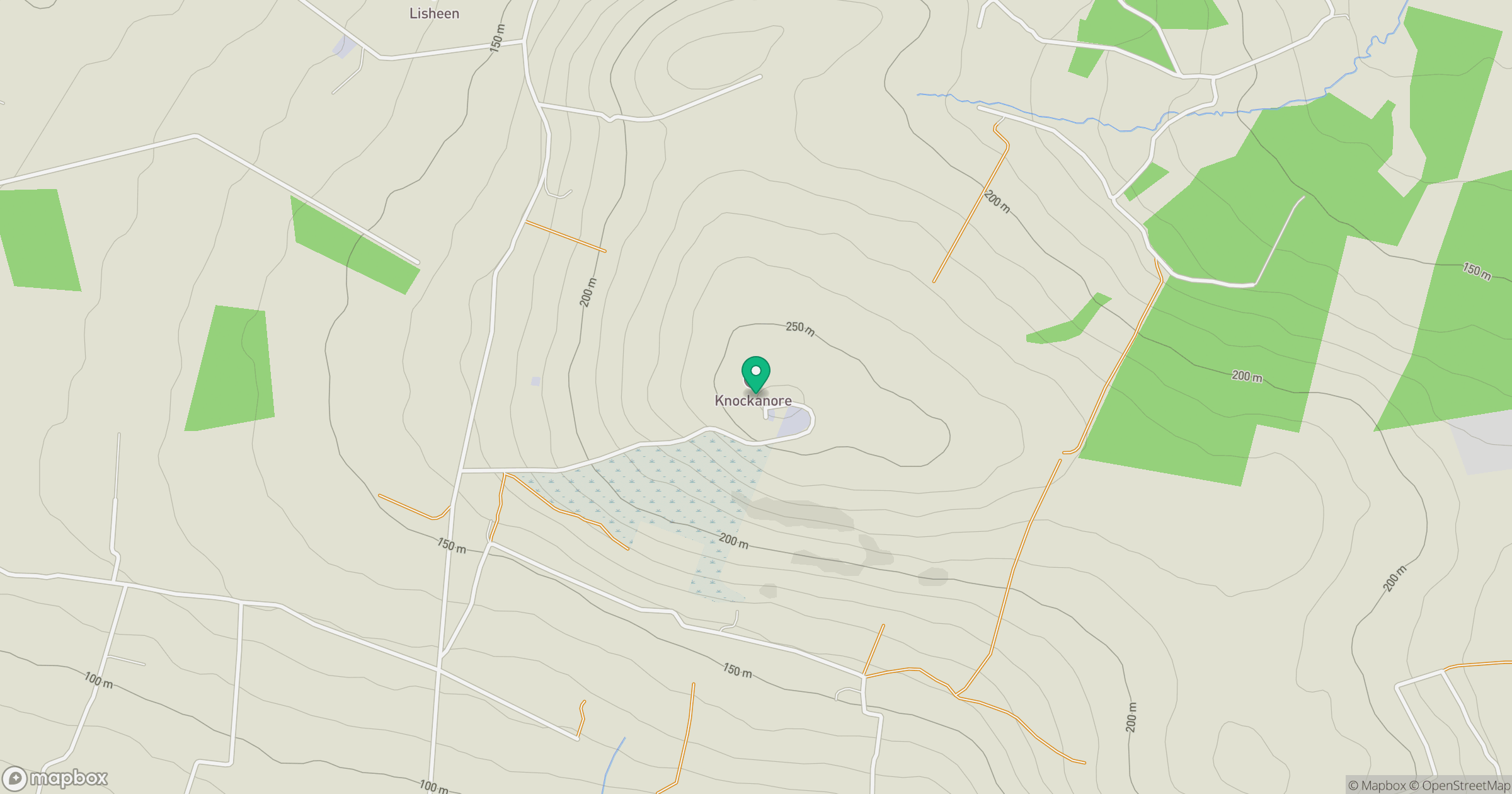
Grid reference: Q910425
View on OpenStreetMapOpens a map in a new tab, centred on the hill.
Hills within 30 km
Straight-line distance, not a walking route or confirmation of access.
No comments yet. Be the first.